Ask Your Maps
Anything
Transform agricultural and windmill analysis into simple conversations.
Upload. Ask. Get insights instantly.
No GIS expertise required. Just upload your satellite imagery, drone photos, or windmill images and chat with AI to analyze crop health, detect windmill defects, and generate professional reports.
Experience the Future of GeoAI
Upload your agricultural or windmill images and chat with AI for instant analysis
See Crew GeoAI in Action
Watch how our revolutionary GeoAI platform transforms agricultural and windmill operations with conversational intelligence.
GIS Software Shouldn't Require a PhD
Current geospatial tools are built for experts, not for the people who actually need the insights.
Complex Software
4-6 months training required
Traditional GIS software requires extensive training and expertise
High Costs
₹50,000+ monthly licenses
Enterprise GIS solutions are prohibitively expensive for most teams
Technical Barriers
Expert-only interfaces
Complex workflows that only specialists can navigate effectively
The Difference is Clear
See how Spatial Mind transforms complex workflows into simple conversations
Complex, time-consuming, expert-only
Install Complex Software
Expert Level
2-3 hours
Import & Georeference Data
Advanced Level
30-45 min
Set Coordinate Systems
Expert Level
15-20 min
Create Project Workspace
Intermediate Level
10-15 min
Load Multiple Layers
Advanced Level
20-30 min
Configure Analysis Tools
Expert Level
45-60 min
Run Spatial Analysis
Expert Level
30-90 min
Interpret Results
Expert Level
60-120 min
Create Visualizations
Advanced Level
45-90 min
Generate Reports
Intermediate Level
30-60 min
Total Time: 6-10 Hours
Requires GIS Expert
Simple, fast, anyone can use
Upload Your Image
Anyone
Ask Your Question
Anyone
Get Instant Results
Anyone
Total Time: 55 Seconds
No Training Required
Conversational GeoAI That Actually Works
Transform complex geospatial analysis into simple conversations. No training required.
Upload
Drag & drop images/videos up to 1GB
Support for JPEG, TIFF, PNG, MP4, GeoTIFF formats
Ask
Chat with AI in natural language
Ask questions like "How many solar panels can fit here?"
Export
Get professional reports instantly
PDF reports, GeoJSON, KML formats available
See It In Action
Watch how a simple conversation can replace hours of complex GIS analysis.
You:
"How many solar panels can fit on this rooftop?"
Crew GeoAI:
"I can fit 24 solar panels on this rooftop with optimal spacing. The total area is 180 sq meters with 85% usable space."
Interactive Chat Demo
Real conversation with AI analysis
Built for Real-World Challenges
Industry-specific solutions that understand your unique requirements and deliver actionable insights.

Defect detection, blade inspection, performance monitoring, maintenance optimization

Crop health analysis, NDVI monitoring, yield prediction, irrigation planning, field management
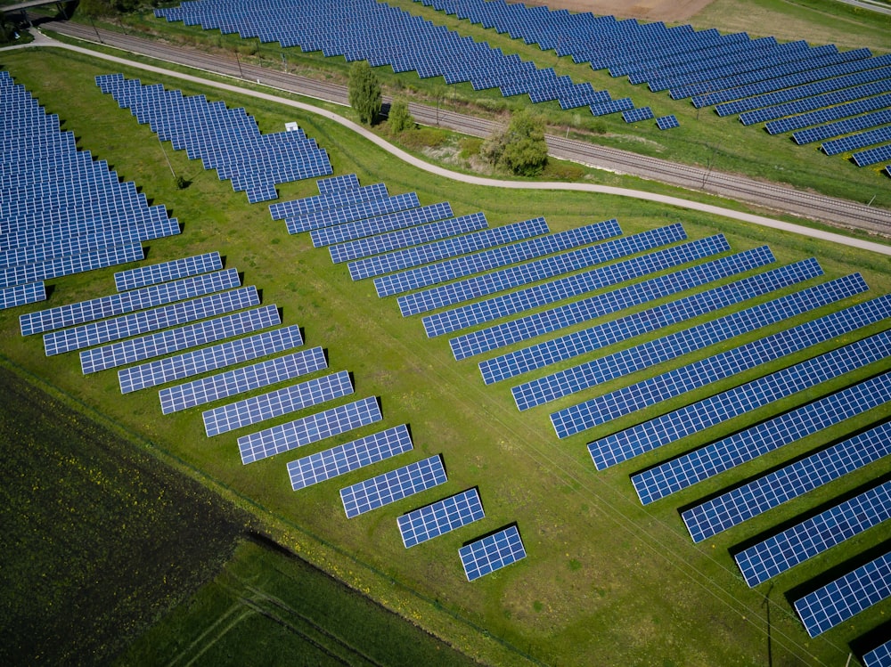
Panel counting, layout optimization, shadow analysis, performance monitoring

Progress tracking, safety compliance, volume calculations, site analysis

Road condition assessment, bridge monitoring, utility mapping, maintenance planning

Land use analysis, zoning compliance, development planning, population density mapping
AI That Thinks Like a Surveyor
Cutting-edge artificial intelligence combined with deep domain expertise to deliver insights that matter.
Natural Language Processing
Ask questions like you would a colleague
No technical jargon required. Just speak naturally and get precise answers.
Automated Object Detection
Buildings, vehicles, infrastructure recognition
Advanced computer vision identifies and classifies objects automatically.
Instant Measurements
Distances, areas, volumes calculated automatically
Precise measurements with sub-meter accuracy using advanced algorithms.
Multi-Model AI
Meta SAM 2, GPT-4V, Gemini working together
Best-in-class AI models collaborate for superior results.
Professional Reports
Export to PDF, GeoJSON, KML formats
Industry-standard formats ready for your existing workflows.
Real-time Processing
Get results in minutes, not hours
Cloud-powered processing delivers insights at unprecedented speed.
See All Features in Action
Live Feature Demo
Interactive walkthrough of all capabilities
Frequently Asked Questions
Get answers to common questions about Crew GeoAI's capabilities and features.
Our AI achieves 95%+ accuracy with human-level precision.
Still have questions? We're here to help.
Ready to Transform Your Workflow?
Join agricultural organizations and wind energy companies transforming their operations with Crew GeoAI.
Stop struggling with complex GIS software. Start having conversations with your maps today.